In the lap of Mullayangiri…

11.09.2016

Some of our friends told us that the sunrise at Mullayangiri would be too good and we decided not to miss it. But our driver is so reluctant to drive us there so early in the morning. As we didn’t understand why he was so reluctant, I called up Mr. Mahesh to convince the driver. But at the very mention of sunrise, he was like as far as he knows there won’t happen any sunrise in Mullayangiri at that point of time and that he won’t recommend a drive to the hill during the dawn. So, we have dropped our plan of starting at 5.30 and we decided to start at 6.00 AM instead.

Jpeg

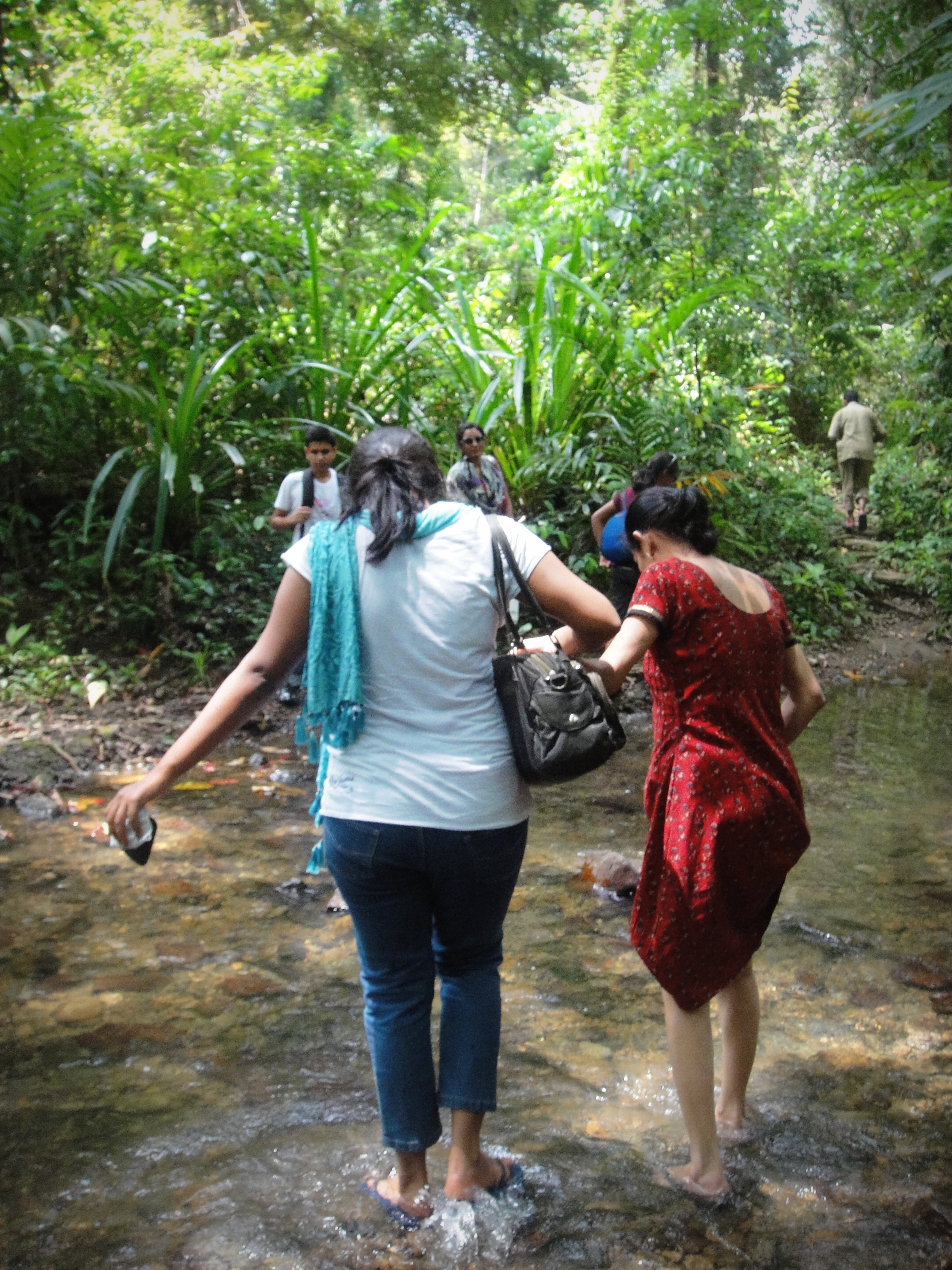
We woke up at 5.30 and were downstairs by 6.00 AM just to see our driver still sleeping in the car. It was only by 6.30 we started our journey to Mullayangiri which is located at a distance of 16 km from Chikmaglore. The drive is an amazing experience as the expanse of greenery on the road sides seems endless, the lofty hills surrounding the way and the coffee blossoms filling our noses. We decided to trek for a short distance rather than reaching the hill-top in our car.

Jpeg

We stopped at Seethalayyanagiri which is 4 kms down from Mullayangiri to start our trek. It was too foggy and cold and alas we forgot our jackets 😀 . After a few steps we saw a stair case leading to the Mallikarjuna Math. The math is most frequented by the members of the Lingayat community. Also found here is a temple dedicated to Seethala and Mallikarjuna and it is believed that the water level here neither decreases nor increases.

Jpeg

We started ascending the hill and the environment around us was quite lively as the Amber Valley School children were also on their cross-country trip on the same day. While a few children were running to reach first, few others were walking as if they are totally out of the competition and were there to relish the moments. We also started running along with them and stopped when we found a trail through the woods beside our road. Though we were not sure whether the trail leads us to the hill-top, we thought of giving a try.

Jpeg

There wasn’t any clear trail of footsteps, but yes we found footmarks might be of some cows, or of goats perhaps, am not sure J The rocks were slippery due to the mist and as it was quite open the speed of wind was more, but it’s one good superb view. The misty mountains, green bushes and soothing breeze, we cherished the moments. After 150 mt or so, the climb turned out to be difficult and we didn’t find any clear trail leading to the hill-top and we decided to climb down and take the road itself 😦 . Though the hike was short, it was quite adventurous and memorable 🙂 🙂

Jpeg

Mullayyanagiri, the highest peak in the Bababudangiri Range, at a height of 1,930 mt, is a trekker’s paradise. It has to be climbed up to savour the real beauty of nature. The best part when once we reached the top is getting Mirchi Bajji 🙂 😉 The chilling wind, a foggy view, a walk around the hill with a bestie and few hot Mirchi Bajji in hands, isn’t this life? 🙂 🙂 . There is a small temple on top of the hill and it is believed that Arabian Sea is visible from the topmost point of this hill on days that boast of clear skies. I doubt whether there can be any such days 😀

Jpeg

After clicking few snaps here, we started descending the hill and it took us very less time to reach Seethalayangiri. We decided to go to another place called Kavikalagandi which is some 6 kms away from Seethalayangiri. We have to ascend few steps in order to see what Kavikalagandi has to offer us. The panoramic view from the top of this view-point is breathtaking. After relishing the calmness of the place, we returned back to our car and headed to Chikmaglur.

Jpeg

On our way back, we stopped at the restaurant “Siri Coffee” and I would definitely recommend this to everyone as one can get fresh breakfast and a tasty brew of coffee. The restaurant is quite happening place and well-maintained. Quick breakfast and we headed to the M.G.Park in chikmaglur, which is not a big one but hosts a toy train :-D. And we didn’t miss it. I won’t say that it’s a must place, but if you have time, you can definitely try..

 Pack up.. :-p

The Sand Bar..

Day 7:

P1110532

After a long and tiring journey the other day, we retired to bed a bit early and slept like hard rocks. The resort which is government-owned was comfortable enough. It was only around 6.30 we woke up just to see both our aunts ready and waiting for us to wake up and get ready for our next adventure, it’s not an adventure in the true sense though!

DSC05040

What is so specific about the place which we are going to visit? Why did we come on such a tiring journey so long? Is the place which we are going to visit is worth the journey? Lots of questions swirled in my mind. We quickly refreshed, had our breakfast and rushed to the Ariel Bay Jetty in Diglipur. There is a forest office at which we got the permits to visit this island. Today it’s going to be a different experience, coz we are not going to take a speed boat which we were accustomed for the past few days but we hired a ‘Dhungi’, which means a country boat.

DSC05049

Though I was so nervous at the beginning, I started to enjoy my ride in the Dhingi. It took us around 30 minutes to reach an island which is known as ‘Ross Island’. Don’t be confused with the Ross about which I wrote a few days back. This is yet another gem in the Andaman and Nicobar archipelago with crystal clear water and a splendid beach. It was around 8.30 in the morning, and there were only a few tourists by the time we reached there, most of them sun bathing!

DSC05044

Soon we jumped out of the Dhungi into the waters as it has to be anchored in the water itself. I noticed another island which is very near to the Ross Island separated by the sea. We thought that we can pay a visit to the other island on our dinghi when once we were done with the Ross. There are few bamboo huts, benches as well as tree-houses on the Ross and our aunts preferred to sit and relax there, while we were out into the beach. The water here is warm, crystal clear and turquoise.

P1110514

It was around 12.30 in the afternoon, when we realized how worth this tiring journey was! It was a low tide at this hour of time and a silky white sand bar surfaced up gradually and it was almost like the sea splitting up to make a way to the other island which is known as the Smith Island. It was one such wonderful sight to see the sand bar emerging which was submerged 10 feet under the water when we reached the Ross Island in the morning (high tide).

P1110474

We were out onto the sand bar heading to the Smith island and the walk lasted for 20 minutes. Smith Island is entirely different from Ross. While Ross is best for activities like Sun bathing, swimming, snorkeling and Scuba diving, Smith which is bigger in size with tropical forest and inhabited, offers nature trails for trekking and hiking. These two islands which are so different in every aspect are the same when it comes to the experience they throw to their visitors.

P1110492

Probably that’s the reason behind them being called as the “Twin islands of Andaman and Nicobar Islands”.  We were back to our resort by 3 pm, had our lunch and relaxed for a while. Gone out for a walk in the evening, but didn’t find anything much interesting.. But I got few good memories to hold back throughout my life 🙂

P1110527

Ross & Smith – An experience which is beyond description 🙂  

The Journey continues..

Day 6:

Finally we arrived at Baratang Island, which is between the South and Middle Andaman. Baratang is known for its beautiful beaches, mangrove creeks, mud-volcanoes and the limestone caves. The Andaman Trunk Road to Rangat and Mayabunder goes through this island. It was around 9 AM in the morning and we decided to go to the limestone caves.

DSC04969

There is a small jetty named Nilambur jetty from where we should get the permission from the forest officials to explore the limestone caves and an official guide can also be hired here. From the jetty, the lime stone caves are half an hour boat ride through a wide creek which leads to Nayadera Jetty. The speed boat soon came to life and we slipped into our life jackets.  The wide sea covered with mangroves on both sides of it is a picturesque scene.

DSC04958

The sea way leading to the Nayadera Jetty becomes narrower and mangroves denser while approaching close to it. The boat ride through these mangroves is magnificent and is an experience in itself. But one should be cautious enough as it is said that there are frequent sightings of crocodiles here. Once out of the boat, there is a broad-way winding its way through the mangroves and opens into a small hamlet where the local people sell some eateries and nimbu-pani (Sweet lime juice) for the tourists visiting the limestone caves. A further 2 kms trek from here through the tropical forest leaves us at the massive sedimentary limestone caves.

DSC04983

There is no way of light to penetrate into these caves. We are awestruck looking at their size; they were so massive and dark. Our guide carried a torch with him which was powerful enough to show us every nook and corner of the caves. This is one of those rare caves that have both stalactites and stalagmites existing in the same caves unlike popularly known fact that these can’t coexist. Lemme just give a brief about them.

Desktop3

Stalagmites are the formations found on the floor of the caves, reaching upward to touch the stalactites hanging from the ceiling. And yet another interesting fact about these caves is that the lime stone structures have been formed over ages and have not been traversed or exploited in any ways. It is still one of those sites that remained untouched by humans 🙂

Desktop4

There are several other interesting things about these caves. The several deposits of the layers of lime formed stones in different shapes and provides different shades to a single massive rock. These caves are like a true break from those beaches, bathing and water sports and a must visit for all the nature lovers. And especially if you are a lover of geography, don’t ever miss visiting these caves.

DSC05018

There are few benches made of bamboo under thatched roofs on the way leading to these caves. One can simply sit and get lost in the wilderness of nature after finishing off the walk through these amazing structures in middle of the mangroves and tropical forests 🙂 🙂

Stay tuned.. My journey for the day isn’t completed yet 😉

The Quest begins…

Day 3:

It was another sunny day. Today’s plan was made out by Sahil. He just knows that there is an unseen place which we should explore. Though he is also not sure what exactly is out there, he was somehow so much interested to go out there. So, it’s decided. We are going to begin our quest; quest for the unseen place.

DSC04869

Most come to Andaman for its beaches, but few explore the hidden beauty of these islands. We are in one such quest now. We weren’t even sure where to go and how to find out that hidden treasure! All that we know are we needed to reach Bamboo flat. One can get a ferry from Port Blair or a boat to reach Bamboo flat. Instead of opting for a ferry, uncle hired us a speed boat so that we can reach the other end in less than 20 minutes or so. On the way to bamboo flat, don’t forget to see the floating dockyard. We can also see the Ross Island from the middle of the channel.

DSC04757

Sahil quickly made an inquiry with a jeep driver and asked if he can guide us to the place we were searching for. Luckily, the driver who is also a local guide told us that he knew the place and was ready to take us over there. We passed through few settlements, which typically reminds us a small village (paraschatan) and in less than another 30 minutes, we reached a place at which our driver stopped the jeep and asked us to follow the foot track on the right side of the road.

DSC04776

Soon we were out of the jeep with our stuff, and asked if the driver is also going to accompany us. He said he would in sometime. We weren’t still sure of what we were behind 🙂 . We were on the track, the track was slippery with mosses and the shrubs that covered the path; and the broken pipes probably supplying water to the settlements were leaking at some places making it more difficult for us to walk. But, we were moving on. The forest was quite calm except for the chirps of the birds and us.

DSC04889

The foot track is narrow and offers an amazing glimpse of the deep forests. After some 200 mts we were at a stream which we have to cross to reach the other end. The cool waters of the stream were so soothing and there were few rocks around where on which we can sit and relax. The next crossing came pretty sooner and then the third and the fourth. The fourth is a bit deeper; I mean it’s up to our knees.

DSC04891

Everyone is eager to find out what is going to be there and what are we searching for. After another 45 mins trek up hill, we reached a place, which is the end point of the quest. The trek finally culminated at a water fall. The water fall called Wimberly Gunj waterfalls, which is located so deep in the forests and the lake which is formed below it in which we can swim is simply enchanting. Looking at the scene, we forgot our tiredness and soon were into the waters.

DSC04778

The experience was so thrilling. This quest turned out to be the best part of the entire trip. The trek through the deep forests, the stream crossings, the water fall and the serenity of the surroundings is truly a lifetime experience. Thanks to Sahil for taking us to this hidden beauty 🙂

DSC04781

The quest ended, but not my day! Wait and watch 😉

Romancing Yumthang…

IMG_20160329_101344

Dr. Joseph Hooker in his “Himalayan Journal” of 1855 mentioned that Lachung and Yumthang are the two most picturesque places in the whole of Sikkim and had even compared them to the valleys of Switzerland. Everyone will agree with him after having the magnificent view of these vast grassy meadows covered with so many flowers of different colours. It was as if a carpet of flowers spread over the bare ground!

IMG_20160329_092443

Yumthang, situated at a height of 11800 ft is located at a distance of about 150 kms from Gangtok. The scenic beauty of this valley of flowers is breathtaking. The alpine meadows covered with primulas, the natural vegetation comprising of silver fir and pines, the blooming Rhododendron forests, the snow peaks of Himalayas with the Lachung River cutting across it is truly a fascinating destination for nature-lovers.

IMG_20160329_124736

The mountain peaks like Pauhunri and Shundu Tsenpa and some other glaciers form the backdrop of the river Teesta. Another speciality of Yumthang is the hotsprings. Yeah, even in the freezing temperatures, one can feel the warmth of this sulfur rich hot water, which is believed to have healing powers. A hot spring is located just right side of the river which is in a close proximity to our base camp. But, didn’t go there as it was snowing continuously and the water was not that warm 😦

DSC_7419

Our next destination is Shiv Mandir; six kms away further north. The trek to this place was so refreshing and exhilarating. The serenity of the valley cannot be described in words and one should experience this at least once in a life time! We started our trek towards Shiv Mandir early in the morning when it started to drizzle. Though the road is quite treacherous, the marvelous scenic views offered by the snow-clad mountains were awesome. Except for the road, everything else which we could see is covered with snow.

20160331_084252

There was a point when we missed the off-road track leading to Shiv Mandir and started stopping the car drivers asking for the directions. Interestingly, almost all the drivers stopped by and were very cordial in guiding us. Not only Yumthang is great, but it’s ambiance too! After trespassing few walls, passing through the barely grown shrubs and plants, sliding down the sloppy ice-sheets, we were at the Shiv Mandir finally.

The temple is dedicated to Lord Shiva. This is not a regular temple; I mean not a big one which we generally see. It was aloof, small, and dark and lit by some lamps. The linga is placed on an elevated platform and there is a small track around it to do the pradakshinas. The tranquility of the premises invokes the spiritual nature of every person who visits this temple. Om Namah Shivaayah!

DSC_0209

Further up and about 23 kms from Yumthang at an altitude of over 15000 ft, there is a place called Zero Point or YumeSamdong. For most of the times, this place remains covered with snow. Without a visit to zero point, the visit to Yumthang would be incomplete! Anyways, my romance with one of the most beautiful places on the earth came to an end with this last trek..

Time to pack my bags.. 🙂

Lachung – the Zumsa governed!!

IMG_20160325_142836

The night was very cold. But probably for the locals, it might be relatively warm. Usually it snows in Lachung till the month of March, but not this time 😀  Seven of us occupied a small room and it was pretty warm, might be because of the abnormal population which occupied it 😀 Yet another sound sleeps 🙂

DSC_0041

Hurrah! It’s a sunny day again. The day started with more like a poll. The poll was about whether we would like to trek to Yumthang on the same day or the next. As we hail from a democratic country, everyone has their own right to say what they feel and ultimately there will be a hung, the same happened there too. Half of us wanted to trek on the same day, while the other half wanted to do it the next. The deadlock got resolved with the intervention of our instructors and it was decided to continue the trek the next day.

DSC_0053

And what we gonna do all the day? Well, we’re going on a hike, not a long one though. We quickly finished off the puri sabji that has been served to us and got ready to go on a walk around the beautiful mountain village Lachung. Lachung, situated at an altitude of 9000 ft is about 115 kms from Gangtok and is the last village in North Sikkim before Yumthang. The village, spread out on either side of the river Lachung Chu, is surrounded by mighty mountains of which some are covered with snow and some not. And the beautiful waterfalls on almost all the mountains add to the charm of this little village.

IMG_20160325_142716

There are lots of hotels and lodges in this village; I think there is a 3-star hotel too. So accommodation is not a problem here and hence became an important tourist spot. There are small shops all along the roads; which sells all kinds of eateries and liquor, which the state is so famous for ;). We followed a road just beside the helipad located in Lachung. The narrow road bifurcates just after crossing the helipad. While the left one leads to Yumthang, the right one leads to the remote parts of this village.

Jpeg

We took the right one, and this is one of the best so far. One can see that the nature is so beautiful as well as feel the wrath of it. Probably this is one the biggest marks of an Avalanche I have seen so far. Perhaps after 5 or 6 kms of walk, we reached a small monastery, sorry for not remembering it’s name (something like Chhuwa). It was so simple, yet very beautiful.. so peaceful with the positive vibes spreading throughout its premises. To my surprise, there was no one in the monastery as well as the premises. The sanctum was on an elevated platform and there were no lights inside except for some flickering butter lamps. I could see a statue of Buddha along with some statues of others, probably of Guru Padmasambava. 

20160326_112939

We were back by 2 pm and went on to a small walk to the helipad in the evening. It was rightly said that the weather is so unpredictable here. The day was so sunny, but by 4 pm the temperatures dropped so drastically and in a while it started to drizzle. We returned to our rooms and started the fun part of dancing and singing, as well as packing for the next days’ as it is going to be tougher.

Wait.. Wait.. Many of you might be thinking that I left something unsaid. The title of the post, right? Well, that is the most important feature of this little beautiful village. Lachung has a unique local and traditional self-government body called the Zumsa, a part of their rich tradition and culture. The Zumsa takes care of all the local disputes and are settled by a totally representative body of the village which is headed by an elected Pipon.

The best is yet to come! Stay tuned!!!

Time to move on! Lachung is waiting!!


DSC_0282

Though the classrooms were way dark and pretty cool, we, at least I managed to grab some good sleep that night. My darling friend Shweta woke me up early in the morning around 4.30 AM and when moved out of the room to the open ground, that was one awesome scene with the twinkling stars up above the sky, the moon throwing some bright light and the tips of the surrounding mountains shining dim in the moon light. But, I couldn’t get a chance to capture that awesome scene as it was extremely difficult to find out my camera in that dark cosy classroom 😦

DSC_7069

It was a sunny day and the weather was clear. We packed our rucksacks and left for breakfast. Before moving on, we quickly cleaned up the surroundings and set on to the track for Lachung, our next base camp at around 7.30 AM. Lachung is a small mountain village located at an altitude of 8600 ft and a distance of about 110 kms from Gangtok and 25 kms from Chungthang. And we gonna trek this 25 kms in a single day. Though excited, we were a bit scared too. Scared not because of the distance, but coz of the off-road route which we gonna follow!

IMG_20160324_142104

The way to Lachung is through quaint villages, scenic spots, and waterfalls. The first leg is of 12 or 13 kms. It’s almost a road trek except for one or two shortcuts. We stopped at a roadside tea spot around 10 AM where we got some buns and tea as refreshments. After relaxing for a short span of 20 minutes, we resumed our trek towards Lachung. They told us that the next leg is of another 12 kms but it’s only at the end of the trek we realized that it is nearly 16 kms.

DSC_7082

The second leg is far more beautiful than the first leg, as there were lots of streams which cut right through the roads, some lush green agri fields probably of some millets or fodder, yaks, Rhododendrons, waterfalls and the beautiful Teesta River running all way along with us. I thoroughly enjoyed this part of the trek as the short hikes through the forests were spine chilling, because of the narrow margins and rough terrain.

DSC_0245We could see more and more number of army people and their vehicles as were nearing Lachung. Before 1950, Lachung served as a trade point between Sikkim and Tibet and after the Chinese annexation, this has been shut down. The Indian Army now has a forward base at Lachung. Finally at around 3.30 PM we reached our base camp at Lachung. A hot meal was served to us and it felt so good to have something hot after a long trek.

20160326_203414

We had lots of fun before having our dinner and retiring to our beds. Lucky enough to get a bed to sleep, but not in the sleeping bag 😀 .  Stay tuned to see what’s waiting for us in Lachung!!

Adieu Gangtok.. Here we come Chungthang!!

DSC_0019

It’s time to move from Gangtok to our final destination Yumthang – the valley of flowers enroute Chungthang and Lachung. And the plan is to reach Chungthang by bus, and to follow a permissible route along the Teesta River to the picturesque riverside village of Lachung and then trek to Yumthang. The route to Chungthang is via Kabi Longtsok, Phodong, Mangan (head quarters of North Sikkim).

JpegWe celebrated Holi – the festival of colors in Gangtok and around 2 pm, set on our journey  to Chungthang, a valley located at a distance of about 100 kms from Gangtok in our buses.  Our first halt on the way was Kabi Longtsok, which is at a distance of about 11 km from the Northern Highway of Gangtok. Kabi Longtsok is a historical place where the colonists from Tibet settled down in the early 14th century.

Jpeg

This spot has witnessed a historical event which came to be known as “the treaty of blood brotherhood”. It was a treaty of friendship in between the Lepcha chief and the Bhutia king to encourage the religious tolerance amongst devotees and people around the state. A stone pillar was also there in memory of this event. The lush green surroundings made this place spell bound. There is also a belief associated with this place. The belief is that if we construct a small stone building and pray for our wishes to come true, they would come true. We too tried our hands at it and succeeded in erecting some stone buildings.

Jpeg

The road leading to Chungthang from here is very rough and narrow, especially filled with large size stones and boulders. The real fun is when there comes a bridge and we all have to get down our buses and cross over the bridges so that our buses and we would be safe :p. 

DSC_0016

Unfortunately a huge stone got stuck in between the back tyres of one of our buses, and we turned out to be fortunate as this gave us a chance of enjoying the scenic beauty of North Sikkim. After struggling for about an hour, finally our drivers succeeded in removing the stone and we resumed our journey. We reached Chungthang around 7 pm and our accommodation was arranged in a school premises which has no electricity.

Jpeg

As it was the month of March, the weather was a bit stable throughout our journey and was relatively warm. But there was a drastic drop in the night temperature and it was very cold in Chungthang. We turned the classrooms into our bedrooms for the night by spreading out carry mats and sleeping bags.

Let me sleep tight tonight, so that I can trek down to the beautiful Lachung tomorrow 🙂 😀

World Environment Day – Gone wild!!

Jpeg

On this June 5 – World Environment Day, the Kerala Forest Department along with WWF India organized a rain walk from Kallar to Ponmudi, a hill-station located at a distance of 61 kms from Trivandrum. Luckily, as it was a Sunday me and my friends decided to go on this trip, though we don’t know whether it rains or not.

Jpeg

We chose the route to Nedumangad-Anad-Vithura-Kallar. We set on our bikes around 6.15 hrs in the morning from Trivandrum to Kallar (42 kms). Truly an adventurous and thrilling drive as the roads were pretty narrow and curvy. And the lush green surroundings full of rubber plantations and coconut grooves, along with the early morning breeze enhanced its charm. As this is my first drive on a bike in Kerala, and has no experience on such roads, I struggled a bit at the beginning, but soon caught up my speed. We reached Kallar around 7.30 hrs.

Jpeg

Quickly completed the process of registration, and watched around to see our group which comprised of some 35 people from different age groups (youngest – 11 yrs and oldest – 60 yrs). I was quite excited. The WWF representatives and the Forest Division Officer, Kerala Forest Dept gave us a quick introduction to the World Environment Day and its theme this year. Once done, they flagged off the walk around 8.00 hrs.

The first one to welcome us is the Kallar river, after which the place Kallar has been named. A bird watching spot. There is the Meenmutti waterfall nearby, but didn’t get a chance to visit it this time :(. This is solely a road trek as they are very much concerned about our safety, but still got good chance of trying the off roads wherever possible.

Jpeg

Ponmudi is situated at about 3000 feet and is home to mountain flowers, butterflies, spiders, springs and rivulets. The way from Kallar to Ponmudi comprises of 22 hairpin bends, probably one of the highest compared with rest of the hill stations in Kerala. The foothills of Ponmudi has few rubber plantations and I was lucky enough to see how the trees secret the latex and how it is being collected in the coconut shells or polythenes that were tied around the trees. The thing which attracted me the most is the down-hill view. It was almost as if the Mother Earth is wrapped up in a thick blanket of lush-green trees and forests.

Desktop3

The cloud-kissed mountains, hills with tea plantations, mountain flowers on the road-sides and giant spiders and web right beside the trees, neat and clean roads, the green canopy, sun-rays playing hide and seek, it is simply one-hell of a beauty! Though the first few kms of distance was tiring, coz of the hot sun, it started to rain in mid-way and all of a sudden the climate changed into a pretty cool one. There was a temple dedicated to Karuppaswamy, a friend of Lord Ayyappa, a tea factory and a PWD Guest House on the way up.

Jpeg

Though it’s a road trek, we tried the off-road ways at the hairpin bends, and trekking through the tea-gardens wherever there were possibilities. It took us around 4 hours (around 13.00 hrs) to reach till the Government Guest House located on top of this hill. We had a good Saadhya (Malayali Lunch), which consisted of the local variety of rice, Aviyal (mix veg curry), Poriyal (a fried stuff), Sambar and the Pepper Rasam with a Papa, provided by the staff there.

Jpeg

The Government Guest house is good enough and very clean. It has a balcony from which we can see the panorama of Western Ghats. Kudos to the forest department people for maintaining the roads and the surroundings so neat and clean! This environment day turned out to be a memorable one for me, as I was really entwined with it. Started our way back around 15.30 hrs and reached Trivandrum by 16.45 hrs. A good week off 🙂


NANDI HILLS – HILL OF HAPPINESS

Photo0277

Nandi Hills or Nandidurg or Nandi Betta is an ancient hill fortress situated at a distance of about 65 kms from Bangalore, Karnataka. These lie at an average elevation of about 4850 ft above the sea level. A popular weekend destination and it can be easily reached as it is well connected by roads with Bangalore as well as Chikkaballapur. The route from Bangalore to Nandi hills is so scenic and interesting, as it gives us a chance of seeing some good temples, old forts, grape vineyards and mustard fields.

Desktop3 (2)

And the curvy roads leading to the top of hills are best to trek or cycle. One can go for a road trek or a wild trek on the backside of the hill. Plenty of opportunities 🙂  If you own a bicycle, well fine and good otherwise there are lots of bicycling clubs which organizes weekend cycling trips. Can try one!

 The main attraction is the statue of the Nandi Bull which is located on top of the hill. And the belief is that the hills resemble a sleeping Nandi Bull, and hence the name Nandi Hills. There is also an ancient temple of Yoga Nandeeswara atop the hill. There are also temples dedicated to Sri Ugra Narasimha and Yoga Narasimha.

Desktop3

The hill is the Sultan Tipu’s Summer Residence and there is a palace which is not open for public 😦 . Interesting place is the Tipu’s Drop, a 600 metre high cliff face, where prisoners and convicts during Tipu’s reign used to be pushed off this cliff. There is also a children’s park, for a while we too can be children swinging on the cradles. Lol!

dfsd 107

Nandi hills is a haven for nature lovers with magnificent views and enticing scenic spots, if we are lucky enough we can spot some wildlife too. One should not miss the sunrise here. The wind, fog and the clouds that blow towards us when we are in the midst of the tall trees on top of the hill before the sunrise is just amazing and a life-time experience. One won’t regret waking up at 4 in the morning after enjoying the sunrise here!

dfsd 089

Why can’t be this weekend itself? 🙂